
Bulusan topographic map
Interactive map
Click on the map to display elevation.
About this map
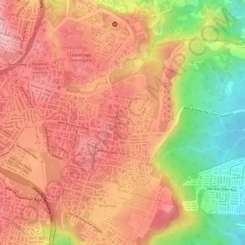
Name: Bulusan topographic map, elevation, terrain.
Average elevation: 131 m
Minimum elevation: 34 m
Maximum elevation: 217 m
Other topographic maps
Click on a map to view its topography, its elevation and its terrain.
Karanganyar
Indonesia > Central Java > Semarang
Karanganyar, Tugu, Semarang, Central Java, Indonesia
Average elevation: 7 m