
Bawiti topographic map
Interactive map
Click on the map to display elevation.
About this map
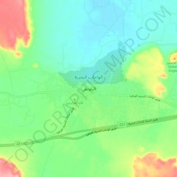
Name: Bawiti topographic map, elevation, terrain.
Location: Bawiti, Giza, 12935, Egypt (28.31182 28.82299 28.39182 28.90299)
Average elevation: 133 m
Minimum elevation: 87 m
Maximum elevation: 242 m
Other topographic maps
Click on a map to view its topography, its elevation and its terrain.