
Loon-Plage topographic map
Interactive map
Click on the map to display elevation.
About this map
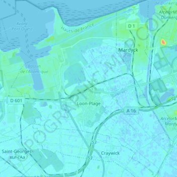
Name: Loon-Plage topographic map, elevation, terrain.
Average elevation: 2 m
Minimum elevation: -5 m
Maximum elevation: 31 m
Other topographic maps
Click on a map to view its topography, its elevation and its terrain.
La Madeleine
France > Hauts-de-France > Nord
La Madeleine, Lille, Nord, Hauts-de-France, Metropolitan France, 59110, France
Average elevation: 30 m
Cysoing
France > Hauts-de-France > Nord
Cysoing, Lille, Nord, Hauts-de-France, Metropolitan France, 59830, France
Average elevation: 39 m
Beaufort
France > Hauts-de-France > Nord
Beaufort, Avesnes-sur-Helpe, Nord, Hauts-de-France, Metropolitan France, 59330, France
Average elevation: 176 m