
Cantabaco topographic map
Interactive map
Click on the map to display elevation.
About this map
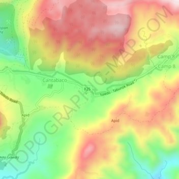
Name: Cantabaco topographic map, elevation, terrain.
Location: Cantabaco, Cebu, Central Visayas, Philippines (10.28521 123.71730 10.32521 123.75730)
Average elevation: 387 m
Minimum elevation: 123 m
Maximum elevation: 638 m