
Gradara topographic map
Interactive map
Click on the map to display elevation.
About this map
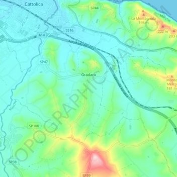
Name: Gradara topographic map, elevation, terrain.
Location: Gradara, Pesaro e Urbino, Marche, 61012, Italy (43.91461 12.73275 43.95299 12.82020)
Average elevation: 62 m
Minimum elevation: 0 m
Maximum elevation: 286 m