
Manito topographic map
Interactive map
Click on the map to display elevation.
About this map
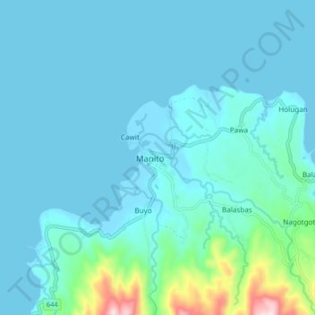
Name: Manito topographic map, elevation, terrain.
Location: Manito, Albay, Bicol Region, 4514, Philippines (13.08448 123.82970 13.16448 123.90970)
Average elevation: 51 m
Minimum elevation: -2 m
Maximum elevation: 459 m
Manito is located on the south-eastern tip of Albay, adjoining the south-eastern limit of Legazpi City. The west and NW coast of Manito lies along Poliqui Bay opposite the city of Legazpi. To the north and north-east coast of the municipality lies Albay Gulf. To the east and south of Manito is the province of Sorsogon separated by the Pocdol Mountains, which is also called as the Bacon-Manito Volcanic Complex. Because of topography, the two provinces are not connected along the coast. A mountain pass from barangay Nagotgot connects Manito to Sorsogon City in Sorsogon province.