
Aringay topographic map
Interactive map
Click on the map to display elevation.
About this map
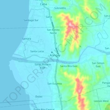
Name: Aringay topographic map, elevation, terrain.
Location: Aringay, La Union, Ilocos Region, 2502, Philippines (16.35467 120.31435 16.43467 120.39435)
Average elevation: 37 m
Minimum elevation: -1 m
Maximum elevation: 286 m
Other topographic maps
Click on a map to view its topography, its elevation and its terrain.