
Sadanga topographic map
Interactive map
Click on the map to display elevation.
About this map
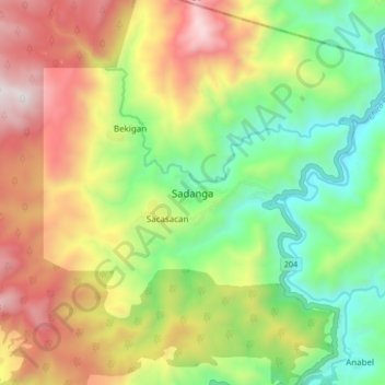
Name: Sadanga topographic map, elevation, terrain.
Location: Sadanga, Mountain Province, Philippines (17.12820 120.98634 17.20820 121.06634)
Average elevation: 1,177 m
Minimum elevation: 606 m
Maximum elevation: 1,922 m
Other topographic maps
Click on a map to view its topography, its elevation and its terrain.
Betwagan
Philippines > Mountain Province > Sadanga
Betwagan, Sadanga, Mountain Province, Cordillera Administrative Region, Philippines
Average elevation: 987 m