
Matag-ob topographic map
Interactive map
Click on the map to display elevation.
About this map
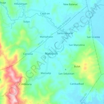
Name: Matag-ob topographic map, elevation, terrain.
Average elevation: 103 m
Minimum elevation: 14 m
Maximum elevation: 443 m
Other topographic maps
Click on a map to view its topography, its elevation and its terrain.
Matag-Ob
Philippines > Leyte > Matag-ob
Matag-Ob, Leyte 4th District, Leyte, Eastern Visayas, 6532, Philippines
Average elevation: 66 m