
Pangil topographic map
Interactive map
Click on the map to display elevation.
About this map
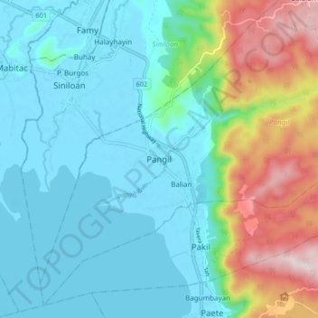
Name: Pangil topographic map, elevation, terrain.
Location: Pangil, Laguna, Calabarzon, 4018, Philippines (14.36291 121.42777 14.44291 121.50777)
Average elevation: 127 m
Minimum elevation: -7 m
Maximum elevation: 526 m
Other topographic maps
Click on a map to view its topography, its elevation and its terrain.
Galalan
Philippines > Laguna > Pangil
Galalan, Pangil, Laguna, Calabarzon, 4019, Philippines
Average elevation: 417 m