
Santa Isabel topographic map
Interactive map
Click on the map to display elevation.
About this map
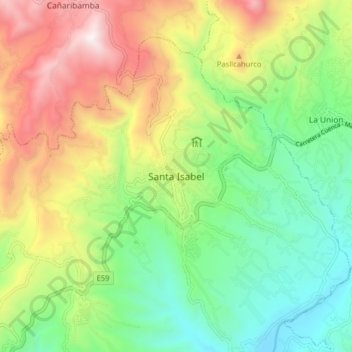
Name: Santa Isabel topographic map, elevation, terrain.
Location: Santa Isabel, Azuay, Ecuador (-3.31418 -79.35516 -3.23418 -79.27516)
Average elevation: 1,554 m
Minimum elevation: 1,011 m
Maximum elevation: 2,403 m