
Batha topographic map
Interactive map
Click on the map to display elevation.
About this map
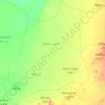
Name: Batha topographic map, elevation, terrain.
Location: Batha, Chad (12.12500 16.95800 16.10900 20.36900)
Average elevation: 368 m
Minimum elevation: 248 m
Maximum elevation: 1,275 m
Other topographic maps
Click on a map to view its topography, its elevation and its terrain.