
Batken topographic map
Interactive map
Click on the map to display elevation.
About this map
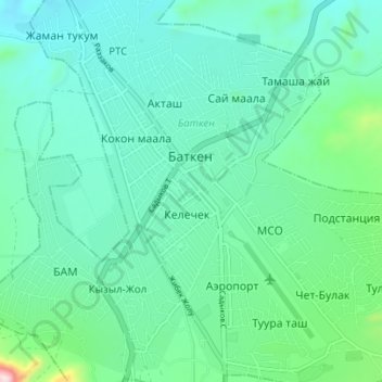
Name: Batken topographic map, elevation, terrain.
Location: Batken, Batken Region, Kyrgyzstan (40.03017 70.79268 40.08334 70.84877)
Average elevation: 1,057 m
Minimum elevation: 976 m
Maximum elevation: 1,419 m
Other topographic maps
Click on a map to view its topography, its elevation and its terrain.
Batken
Kyrgyzstan > Batken Region > Batken
Batken, Batken Region, 720105, Kyrgyzstan
Average elevation: 1,064 m