
Monte San Giovanni in Sabina topographic map
Interactive map
Click on the map to display elevation.
About this map
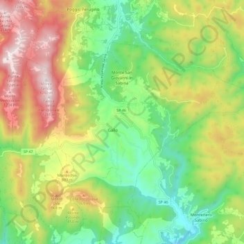
Name: Monte San Giovanni in Sabina topographic map, elevation, terrain.
Location: Monte San Giovanni in Sabina, Rieti, Latium, Italien (42.28445 12.72574 42.34057 12.83798)
Average elevation: 724 m
Minimum elevation: 334 m
Maximum elevation: 1,280 m
Monte San Giovanni in Sabina liegt 76 km nördlich von Rom und 20 km südwestlich von Rieti auf einem Hügel in den Sabiner Bergen. Das Gemeindegebiet erstreckt sich über eine Höhendifferenz von 420 bis 1292 m s.l.m. Monte San Giovanni in Sabina ist Mitglied der Comunità Montana Montepiano Reatino.
Other topographic maps
Click on a map to view its topography, its elevation and its terrain.