
Santo Tomas topographic map
Interactive map
Click on the map to display elevation.
About this map
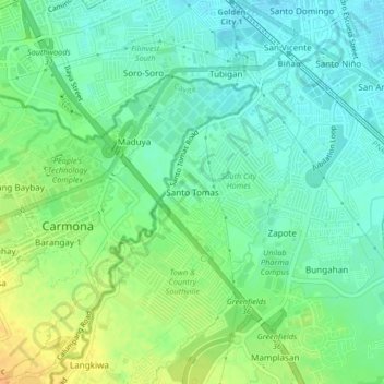
Name: Santo Tomas topographic map, elevation, terrain.
Location: Santo Tomas, Biñan, Laguna, Calabarzon, 4024, Philippines (14.29696 121.05080 14.33696 121.09080)
Average elevation: 20 m
Minimum elevation: 8 m
Maximum elevation: 39 m
Other topographic maps
Click on a map to view its topography, its elevation and its terrain.
Santo Tomas
Philippines > Laguna > Santo Tomas
Santo Tomas, Luisiana, Laguna, Calabarzon, 4032, Philippines
Average elevation: 381 m