
Castelló d'Empúries topographic map
Interactive map
Click on the map to display elevation.
About this map
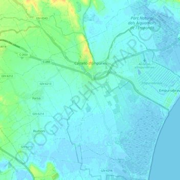
Name: Castelló d'Empúries topographic map, elevation, terrain.
Location: Castelló d'Empúries, Oberampurien, Girona, Katalonien, Spanien (42.20387 3.04931 42.28855 3.15048)
Average elevation: 4 m
Minimum elevation: -4 m
Maximum elevation: 24 m