
Kawagoe topographic map
Interactive map
Click on the map to display elevation.
About this map
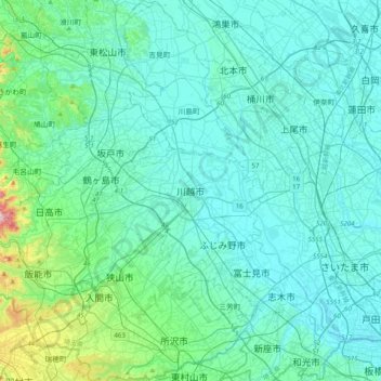
Name: Kawagoe topographic map, elevation, terrain.
Location: Kawagoe, Saitama Prefecture, Kanto, 350-0065, Japan (35.76511 139.32569 36.08511 139.64569)
Average elevation: 44 m
Minimum elevation: -3 m
Maximum elevation: 373 m