
Aguijan topographic map
Interactive map
Click on the map to display elevation.
About this map
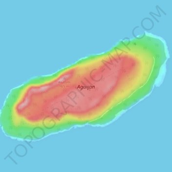
Name: Aguijan topographic map, elevation, terrain.
Average elevation: 35 m
Minimum elevation: 0 m
Maximum elevation: 176 m
Other topographic maps
Click on a map to view its topography, its elevation and its terrain.
Farallon de Medinilla
United States of America (CNMI) > Northern Mariana Islands
Farallon de Medinilla, Northern Islands Municipality, Northern Mariana Islands, United States of America (CNMI)
Average elevation: 3 m