
Fraureuth topographic map
Interactive map
Click on the map to display elevation.
About this map
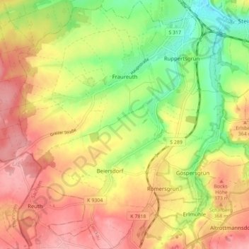
Name: Fraureuth topographic map, elevation, terrain.
Location: Fraureuth, Zwickau, Saksen, 08427, Duitsland (50.66323 12.31307 50.71799 12.39483)
Average elevation: 343 m
Minimum elevation: 282 m
Maximum elevation: 393 m