
Landshut topographic map
Interactive map
Click on the map to display elevation.
About this map
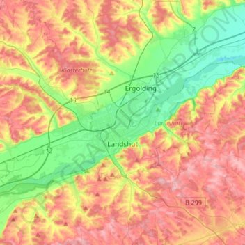
Name: Landshut topographic map, elevation, terrain.
Location: Landshut, Beieren, 84028, Niederbayern (48.50700 12.01822 48.59559 12.28449)
Average elevation: 444 m
Minimum elevation: 368 m
Maximum elevation: 525 m