
Salvacion topographic map
Interactive map
Click on the map to display elevation.
About this map
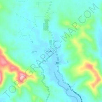
Name: Salvacion topographic map, elevation, terrain.
Location: Salvacion, Puerto Princesa, Mimaropa, Philippines (9.94726 118.76390 9.98726 118.80390)
Average elevation: 48 m
Minimum elevation: 1 m
Maximum elevation: 207 m
Other topographic maps
Click on a map to view its topography, its elevation and its terrain.