
Mummelsee topographic map
Interactive map
Click on the map to display elevation.
About this map
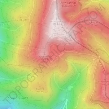
Name: Mummelsee topographic map, elevation, terrain.
Average elevation: 918 m
Minimum elevation: 555 m
Maximum elevation: 1,163 m
Other topographic maps
Click on a map to view its topography, its elevation and its terrain.
Ruhestein
Deutschland > Baden-Württemberg > Seebach
Ruhestein, Seebach, Verwaltungsverband Kappelrodeck, Ortenaukreis, Baden-Württemberg, 77889, Deutschland
Average elevation: 895 m