
Allgau topographic map
Interactive map
Click on the map to display elevation.
About this map
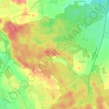
Name: Allgau topographic map, elevation, terrain.
Location: Allgau, Bayern, Oberbayern, Beieren, 83627, Duitsland (47.80416 11.66224 47.84416 11.70224)
Average elevation: 742 m
Minimum elevation: 698 m
Maximum elevation: 780 m