
Sant Gregori topographic map
Interactive map
Click on the map to display elevation.
About this map
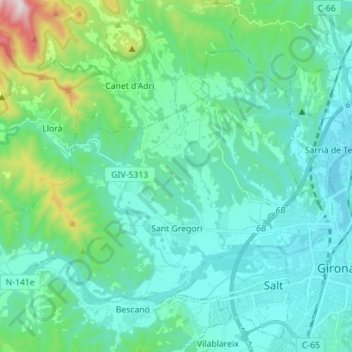
Name: Sant Gregori topographic map, elevation, terrain.
Location: Sant Gregori, Gironés, Gerona, Cataluña, 17150, España (41.96884 2.66510 42.04368 2.80517)
Average elevation: 185 m
Minimum elevation: 55 m
Maximum elevation: 818 m