
Hirson topographic map
Interactive map
Click on the map to display elevation.
About this map
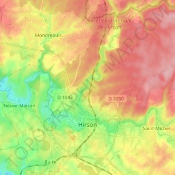
Name: Hirson topographic map, elevation, terrain.
Location: Hirson, Vervins, Aisne, Hauts-de-France, France, 02500, France (49.89681 4.05253 49.97903 4.17379)
Average elevation: 207 m
Minimum elevation: 142 m
Maximum elevation: 263 m