
Lander County topographic map
Interactive map
Click on the map to display elevation.
About this map
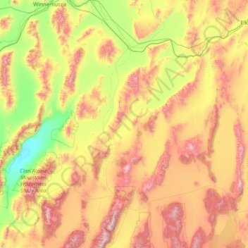
Name: Lander County topographic map, elevation, terrain.
Location: Lander County, Nevada, United States (39.09334 -117.80528 41.00114 -116.58745)
Average elevation: 1,768 m
Minimum elevation: 1,030 m
Maximum elevation: 3,354 m
The 11,477 ft (3498 m) summit of Bunker Hill, located in the Toiyabe Range near the Nye County border, is the highest point in the county while the county's most topographically prominent peak is Mount Lewis.
Other topographic maps
Click on a map to view its topography, its elevation and its terrain.
Mud Springs
United States > Nevada > Lincoln County
Mud Springs, Lincoln County, Nevada, United States
Average elevation: 2,206 m
Las Vegas
United States > Nevada > Clark County
Las Vegas, Clark County, Nevada, United States
Average elevation: 756 m
Henderson
United States > Nevada > Clark County
Henderson, Clark County, Nevada, United States
Average elevation: 691 m
Whitney
United States > Nevada > Clark County
Whitney, Clark County, Nevada, 89112, United States
Average elevation: 524 m
Aurora Hill
United States > Nevada > Mineral County
Aurora Hill, Mineral County, Nevada, United States
Average elevation: 2,272 m
White Pine County
White Pine County, Nevada, United States
Average elevation: 2,049 m
Churchill County
Churchill County, Nevada, United States
Average elevation: 1,476 m