
Chūbu topographic map
Interactive map
Click on the map to display elevation.
About this map
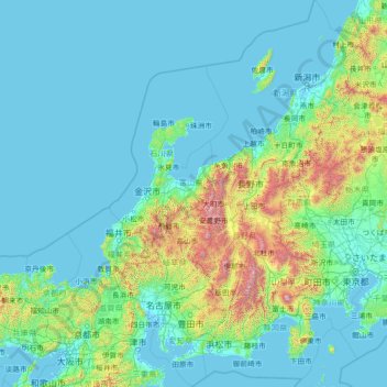
Name: Chūbu topographic map, elevation, terrain.
Location: Chūbu, Japon (34.27630 135.44934 38.89731 139.89989)
Average elevation: 264 m
Minimum elevation: -4 m
Maximum elevation: 3,662 m
Other topographic maps
Click on a map to view its topography, its elevation and its terrain.