
Wattwil topographic map
Interactive map
Click on the map to display elevation.
About this map
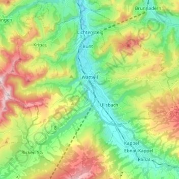
Name: Wattwil topographic map, elevation, terrain.
Location: Wattwil, Wahlkreis Toggenburg, Saint-Gall, Suisse (47.24968 9.02036 47.33864 9.15305)
Average elevation: 853 m
Minimum elevation: 592 m
Maximum elevation: 1,322 m