
Hong Kong Island topographic map
Interactive map
Click on the map to display elevation.
About this map
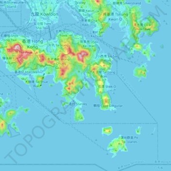
Name: Hong Kong Island topographic map, elevation, terrain.
Location: Hong Kong Island, Southern District, Hong Kong, 852, China (22.19265 114.11010 22.27561 114.30905)
Average elevation: 36 m
Minimum elevation: -6 m
Maximum elevation: 532 m
Other topographic maps
Click on a map to view its topography, its elevation and its terrain.
Shui Choi Tin Village
China > Hong Kong > Hong Kong Island
Shui Choi Tin Village, Southern District, Hong Kong Island, Hong Kong, China
Average elevation: 94 m
Victoria Peak
China > Hong Kong > Hong Kong Island
Victoria Peak, Hong Kong Island, Hong Kong, 000000, China
Average elevation: 209 m
Eastern District
China > Hong Kong > Hong Kong Island
Eastern District, Hong Kong Island, Hong Kong, China
Average elevation: 84 m