
Thank you for supporting this site ❤️
Make a donation
Make a donation
Riccione topographic map
Click on the map to display elevation.
Thank you for supporting this site ❤️
Make a donation
Make a donation
Riccione
Riccione's principal hill, to its south, is known as Cavrèt d'Arvura. Riccione's maximum elevation is 75 metres (246 feet) above sea level, with a mean elevation of 15.2 metres (50 feet).
Thank you for supporting this site ❤️
Make a donation
Make a donation
About this map
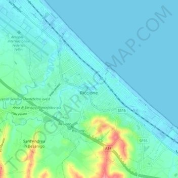
Name: Riccione topographic map, elevation, terrain.
Location: Riccione, Rimini, Emilia-Romagna, Italy (43.97382 12.60169 44.02534 12.68875)
Average elevation: 14 m
Minimum elevation: -4 m
Maximum elevation: 85 m
Thank you for supporting this site ❤️
Make a donation
Make a donation
Other topographic maps
Click on a map to view its topography, its elevation and its terrain.