
Thank you for supporting this site ❤️
Make a donation
Make a donation
Harju maakond topographic map
Click on the map to display elevation.
Thank you for supporting this site ❤️
Make a donation
Make a donation
About this map
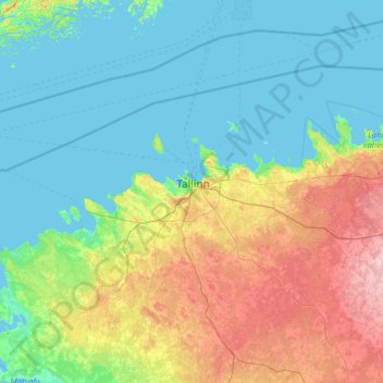
Name: Harju maakond topographic map, elevation, terrain.
Location: Harju maakond, Estonia (58.99166 23.52167 59.82667 26.02167)
Average elevation: 26 m
Minimum elevation: -2 m
Maximum elevation: 126 m
Thank you for supporting this site ❤️
Make a donation
Make a donation
Other topographic maps
Click on a map to view its topography, its elevation and its terrain.