
Thank you for supporting this site ❤️
Make a donation
Make a donation
Massa-Carrara topographic map
Click on the map to display elevation.
Thank you for supporting this site ❤️
Make a donation
Make a donation
About this map
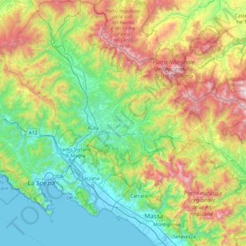
Name: Massa-Carrara topographic map, elevation, terrain.
Location: Massa-Carrara, Tuscany, Italy (43.97532 9.68677 44.47254 10.25571)
Average elevation: 604 m
Minimum elevation: -3 m
Maximum elevation: 2,079 m
Thank you for supporting this site ❤️
Make a donation
Make a donation
Other topographic maps
Click on a map to view its topography, its elevation and its terrain.
Thank you for supporting this site ❤️
Make a donation
Make a donation
Thank you for supporting this site ❤️
Make a donation
Make a donation