
Thank you for supporting this site ❤️
Make a donation
Make a donation
Mansfield topographic map
Click on the map to display elevation.
Thank you for supporting this site ❤️
Make a donation
Make a donation
About this map
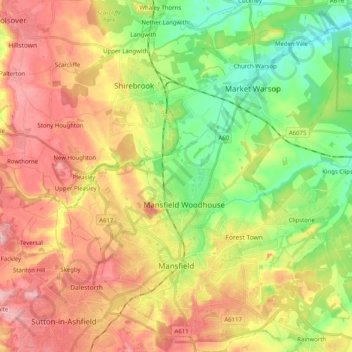
Name: Mansfield topographic map, elevation, terrain.
Location: Mansfield, Nottinghamshire, England, United Kingdom (53.11479 -1.26007 53.23561 -1.09477)
Average elevation: 117 m
Minimum elevation: 42 m
Maximum elevation: 197 m
Thank you for supporting this site ❤️
Make a donation
Make a donation
Other topographic maps
Click on a map to view its topography, its elevation and its terrain.