

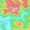
Tidal River topographic map
Click on the map to display elevation.
About this map

Name: Tidal River topographic map, elevation, terrain.
Average elevation: 136 m
Minimum elevation: 0 m
Maximum elevation: 475 m
Other topographic maps
Click on a map to view its topography, its elevation and its terrain.
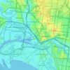
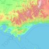
City of Melbourne
Melbourne's topography is characterized by a diverse landscape that transitions from flat coastal plains to rolling hills and mountainous regions. The city is situated at the northern end of Port Phillip Bay, where the terrain is predominantly flat, facilitating urban development. As one moves eastward, the…
Average elevation: 18 m
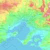
Melbourne
Melbourne is also prone to isolated convective showers forming when a cold pool crosses the state, especially if there is considerable daytime heating. These showers are often heavy and can include hail, squalls, and significant drops in temperature, but they often pass through very quickly with a rapid…
Average elevation: 185 m
Melbourne
Melbourne is also prone to isolated convective showers forming when a cold pool crosses the state, especially if there is considerable daytime heating. These showers are often heavy and can include hail, squalls, and significant drops in temperature, but they often pass through very quickly with a rapid…
Average elevation: 185 m
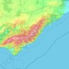
Melbourne
Melbourne is also prone to isolated convective showers forming when a cold pool crosses the state, especially if there is considerable daytime heating. These showers are often heavy and can include hail, squalls, and significant drops in temperature, but they often pass through very quickly with a rapid…
Average elevation: 49 m

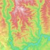
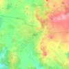
Ballarat
Ballarat has a moderate oceanic climate (Köppen climate classification Cfb) with four distinct seasons. Its elevation, ranging between 400 and 630 metres (1,310 and 2,070 feet) above sea level, causes its mean monthly temperatures to tend to be on average 3 to 5 °C (5 to 9 °F) below those of Melbourne,…
Average elevation: 470 m

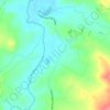


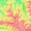











Castlemaine
The Castlemaine goldfields' legendary prosperity raised expectations of Castlemaine becoming Victoria's second city. That is reflected in imposing buildings erected in the town's first few years. Though the rich alluvial diggings were largely exhausted within 15–20 years causing the town's population to…
Average elevation: 319 m




Ballarat
Ballarat has a moderate oceanic climate (Köppen climate classification Cfb) with four distinct seasons. Its elevation, ranging between 400 and 630 metres (1,310 and 2,070 feet) above sea level, causes its mean monthly temperatures to tend to be on average 3 to 5 °C (5 to 9 °F) below those of Melbourne,…
Average elevation: 470 m


Macedon
Newspaper articles from the late 19th and early 20th century describe the wide variety of plants that flourished at the State Nursery in spite of its poor topsoil and craggy terrain. Cool-climate trees like cypress, larch, cedar and pine thrived at the high altitude; deciduous species of oak, ash and birch…
Average elevation: 542 m


Horsham
Horsham's topography is flat, approximately 128 metres (420 ft) above sea level. The central business district (CBD) is laid out in a grid plan south of the train line and is characterised by wide streets and several roundabouts. Firebrace Street, running north–south through the middle of the CBD is one of…
Average elevation: 129 m







Mount Noorat
Mount Noorat is a major volcano of the Newer Volcanics Province of Victoria, with a peak height of 310 metres above sea level and a crater between 160 and 200 metres. It is characterised by multiple vents, a complex topography, and the deepest scoria enclosed crater in Victoria. The mount illustrates a…
Average elevation: 176 m










Frankston
Australia > Victoria > Frankston
Olivers Hill is the most prominent elevation in Frankston which rises to 55 metres above sea level (180 feet) at its highest point in the suburb. Its origins date to approximately 415 to 360 million years ago. Its base is Mount Eliza Granite dating from the Devonian period, which was covered in lava tuffs in…
Average elevation: 36 m