
Thank you for supporting this site ❤️
Make a donation
Make a donation
San Luis topographic map
Click on the map to display elevation.
Thank you for supporting this site ❤️
Make a donation
Make a donation
About this map
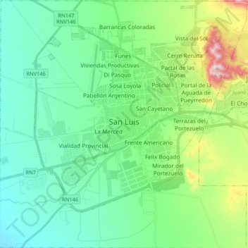
Name: San Luis topographic map, elevation, terrain.
Location: San Luis, Juan Martín de Pueyrredón, San Luis, Argentina (-33.37148 -66.41845 -33.23579 -66.25674)
Average elevation: 734 m
Minimum elevation: 593 m
Maximum elevation: 1,191 m
Thank you for supporting this site ❤️
Make a donation
Make a donation