
Thank you for supporting this site ❤️
Make a donation
Make a donation
San Marcos topographic map
Click on the map to display elevation.
Thank you for supporting this site ❤️
Make a donation
Make a donation
About this map
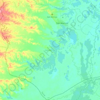
Name: San Marcos topographic map, elevation, terrain.
Location: San Marcos, San Jorge, Sucre, RAP Caribe, Colombia (8.39830 -75.34725 8.74066 -75.01328)
Average elevation: 25 m
Minimum elevation: 10 m
Maximum elevation: 88 m
Thank you for supporting this site ❤️
Make a donation
Make a donation
Other topographic maps
Click on a map to view its topography, its elevation and its terrain.