
Thank you for supporting this site ❤️
Make a donation
Make a donation
Province of Atalaya topographic map
Click on the map to display elevation.
Thank you for supporting this site ❤️
Make a donation
Make a donation
About this map
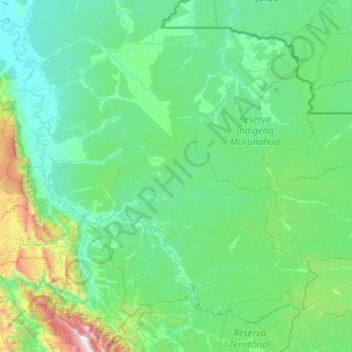
Name: Province of Atalaya topographic map, elevation, terrain.
Location: Province of Atalaya, Ucayali, 25201, Peru (-11.44841 -74.57300 -9.41140 -72.12017)
Average elevation: 440 m
Minimum elevation: 153 m
Maximum elevation: 3,652 m
Thank you for supporting this site ❤️
Make a donation
Make a donation
Other topographic maps
Click on a map to view its topography, its elevation and its terrain.