
Whitby topographic map
Interactive map
Click on the map to display elevation.
About this map
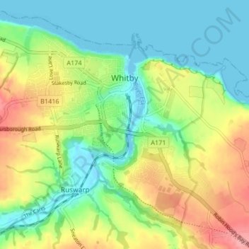
Name: Whitby topographic map, elevation, terrain.
Location: Whitby, North Yorkshire, England, United Kingdom (54.46322 -0.65868 54.49684 -0.59179)
Average elevation: 37 m
Minimum elevation: -4 m
Maximum elevation: 99 m
Other topographic maps
Click on a map to view its topography, its elevation and its terrain.
Scarborough
United Kingdom > England > North Yorkshire
Scarborough, North Yorkshire, England, YO11 1LP, United Kingdom
Average elevation: 39 m