
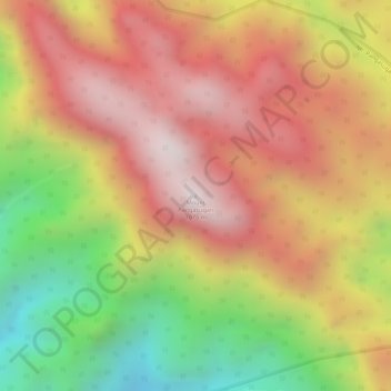
Mount Pangasugan topographic map
Interactive map
Click on the map to display elevation.
About this map
Name: Mount Pangasugan topographic map, elevation, terrain.
Average elevation: 712 m
Minimum elevation: 204 m
Maximum elevation: 1,070 m
Other topographic maps
Click on a map to view its topography, its elevation and its terrain.
Patag
Philippines > Leyte > Baybay
Patag, Baybay, 5th District, Leyte, Eastern Visayas, 6521, Philippines
Average elevation: 64 m
Palhi
Philippines > Leyte > Baybay
Palhi, Baybay, 5th District, Leyte, Eastern Visayas, 6521, Philippines
Average elevation: 20 m
Baybay
Philippines > Leyte > Baybay
Baybay, Leyte 5th District, Leyte, Eastern Visayas, 6521, Philippines
Average elevation: 163 m
Lower Utod (Guadalupe)
Philippines > Leyte > Baybay
Lower Utod (Guadalupe), Baybay, Leyte 5th District, Leyte, Eastern Visayas, 6521, Philippines
Average elevation: 29 m
Pagbanganan River
Philippines > Leyte > Baybay > Kantagnos
Pagbanganan River, Kantagnos, Baybay, Leyte 5th District, Leyte, Eastern Visayas, 6521, Philippines
Average elevation: 145 m
Mailhi
Philippines > Leyte > Baybay > Mailhi
Mailhi, Baybay, Leyte 5th District, Leyte, Eastern Visayas, 6521, Philippines
Average elevation: 237 m
Caridad
Philippines > Leyte > Baybay > Caridad
Caridad, Baybay, Leyte 5th District, Leyte, Eastern Visayas, 6521, Philippines
Average elevation: 33 m
Pangasugan River
Philippines > Leyte > Baybay
Pangasugan River, Baybay, Leyte 5th District, Leyte, Eastern Visayas, 6521, Philippines
Average elevation: 194 m