
Mersing topographic map
Click on the map to display elevation.
About this map
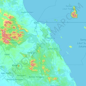
Name: Mersing topographic map, elevation, terrain.
Location: Mersing, Johor, Malaysia (2.04294 103.29040 2.66888 104.54151)
Average elevation: 49 m
Minimum elevation: -3 m
Maximum elevation: 966 m
Other topographic maps
Click on a map to view its topography, its elevation and its terrain.