
Thank you for supporting this site ❤️
Make a donation
Make a donation
Castel San Giovanni topographic map
Click on the map to display elevation.
Thank you for supporting this site ❤️
Make a donation
Make a donation
About this map
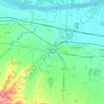
Name: Castel San Giovanni topographic map, elevation, terrain.
Location: Castel San Giovanni, Piacenza, Emilia-Romagna, 29015, Italy (45.01846 9.36951 45.09772 9.48604)
Average elevation: 81 m
Minimum elevation: 46 m
Maximum elevation: 192 m
Thank you for supporting this site ❤️
Make a donation
Make a donation
Other topographic maps
Click on a map to view its topography, its elevation and its terrain.