
Province of Sullana topographic map
Click on the map to display elevation.
About this map
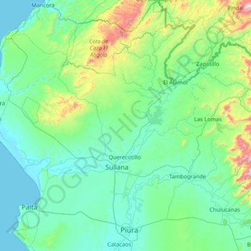
Name: Province of Sullana topographic map, elevation, terrain.
Location: Province of Sullana, Piura, Peru (-5.29836 -80.96826 -4.07933 -80.20148)
Average elevation: 253 m
Minimum elevation: -1 m
Maximum elevation: 2,063 m
Other topographic maps
Click on a map to view its topography, its elevation and its terrain.