
Thank you for supporting this site ❤️
Make a donation
Make a donation
South-East topographic map
Click on the map to display elevation.
Thank you for supporting this site ❤️
Make a donation
Make a donation
About this map
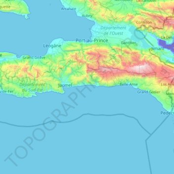
Name: South-East topographic map, elevation, terrain.
Location: South-East, Haiti (18.03150 -73.01559 18.40560 -71.72493)
Average elevation: 234 m
Minimum elevation: -43 m
Maximum elevation: 2,627 m
Thank you for supporting this site ❤️
Make a donation
Make a donation
Other topographic maps
Click on a map to view its topography, its elevation and its terrain.