
Kent topographic map
Click on the map to display elevation.
About this map
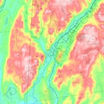
Name: Kent topographic map, elevation, terrain.
Average elevation: 255 m
Minimum elevation: 83 m
Maximum elevation: 436 m
Other topographic maps
Click on a map to view its topography, its elevation and its terrain.
East Summit
United States > Connecticut > Northwest Hills Planning Region > Norfolk
Average elevation: 431 m