
Thank you for supporting this site ❤️
Make a donation
Make a donation
Tenom topographic map
Click on the map to display elevation.
Thank you for supporting this site ❤️
Make a donation
Make a donation
About this map
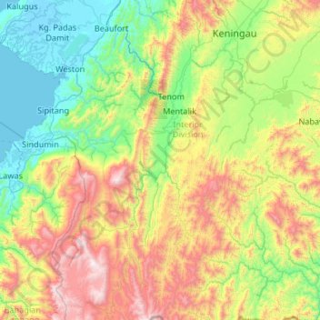
Name: Tenom topographic map, elevation, terrain.
Location: Tenom, Interior Division, Sabah, 89900, Malaysia (4.38100 115.75612 5.43968 116.13104)
Average elevation: 579 m
Minimum elevation: -4 m
Maximum elevation: 2,002 m
Thank you for supporting this site ❤️
Make a donation
Make a donation
Other topographic maps
Click on a map to view its topography, its elevation and its terrain.