
Thank you for supporting this site ❤️
Make a donation
Make a donation
The Woodlands topographic map
Click on the map to display elevation.
Thank you for supporting this site ❤️
Make a donation
Make a donation
The Woodlands
The Woodlands is in a heavily forested area, and much of the community has retained trees for shade and decoration. The terrain is essentially flat, with the exception of topographic variations ranging from 125 to 175 feet above sea level between Spring Creek and Flintridge Drive.
Thank you for supporting this site ❤️
Make a donation
Make a donation
About this map
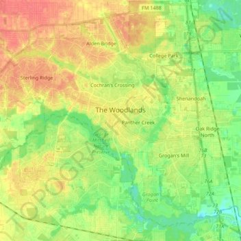
Name: The Woodlands topographic map, elevation, terrain.
Location: The Woodlands, Montgomery County, Texas, United States (30.10304 -95.60120 30.23057 -95.43430)
Average elevation: 47 m
Minimum elevation: 23 m
Maximum elevation: 72 m
Thank you for supporting this site ❤️
Make a donation
Make a donation