
Suamico topographic map
Click on the map to display elevation.
About this map
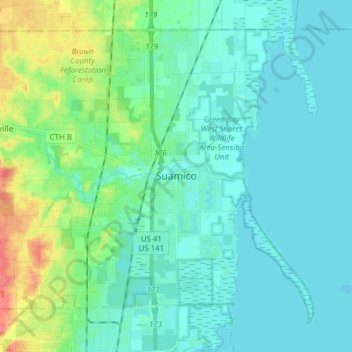
Name: Suamico topographic map, elevation, terrain.
Location: Suamico, Brown County, Wisconsin, 54173, United States (44.58589 -88.13141 44.67764 -87.97743)
Average elevation: 187 m
Minimum elevation: 175 m
Maximum elevation: 231 m
Other topographic maps
Click on a map to view its topography, its elevation and its terrain.