
Make a donation
Algiers topographic map
Click on the map to display elevation.
Make a donation
Algiers
The city contains the largest infrastructure facilities in the country; railway and highway connections with neighbouring cities and international links via the Houari Boumediene Airport and Algiers Ferry Terminal. Algiers possesses notable mass transit options, that includes the Algiers Metro, the city's subway system that recorded about 46 million passengers in 2023, alongside the Algiers tramway and several Gondola lift lines helping with the difference in elevation, in addition to many bus lines connecting the suburbs and major population centers.
Make a donation
About this map
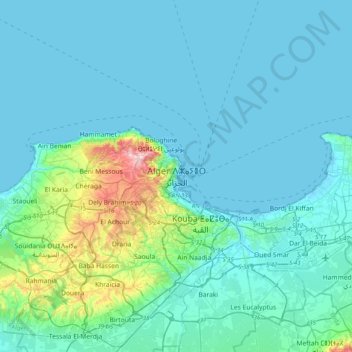
Name: Algiers topographic map, elevation, terrain.
Location: Algiers, Sidi M'Hamed District, Algiers, 16000, Algeria (36.61293 2.89884 36.93293 3.21884)
Average elevation: 45 m
Minimum elevation: -2 m
Maximum elevation: 393 m
Make a donation
Other topographic maps
Click on a map to view its topography, its elevation and its terrain.