
Thank you for supporting this site ❤️
Make a donation
Make a donation
Garner topographic map
Click on the map to display elevation.
Thank you for supporting this site ❤️
Make a donation
Make a donation
About this map
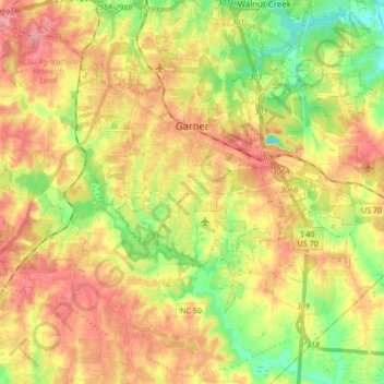
Name: Garner topographic map, elevation, terrain.
Location: Garner, Wake County, North Carolina, United States (35.64401 -78.70052 35.73131 -78.53157)
Average elevation: 94 m
Minimum elevation: 46 m
Maximum elevation: 137 m
Thank you for supporting this site ❤️
Make a donation
Make a donation