

Marrakesh topographic map
Click on the map to display elevation.
Marrakesh
The city is located in the Tensift River valley, with the Tensift River passing along the northern edge of the city. The Ourika River valley is about 30 kilometres (19 mi) south of Marrakesh. The city has expanded north from the old centre with suburbs such as Daoudiat, Diour El Massakine, Sidi Abbad, Sakar and Amerchich, to the southeast with Sidi Youssef Ben Ali, to the west with Massira and Targa, and southwest to M'hamid beyond the airport. On the P2017 road leading south out of the city are large villages such as Douar Lahna, Touggana, Lagouassem, and Lahebichate, leading eventually through desert to the town of Tahnaout at the edge of the High Atlas, the highest mountainous barrier in North Africa. The average elevation of the snow-covered High Atlas lies above 3,000 metres (9,800 ft). It is mainly composed of Jurassic limestone. The mountain range runs along the Atlantic coast, then rises to the east of Agadir and extends northeast into Algeria before disappearing into Tunisia.
About this map
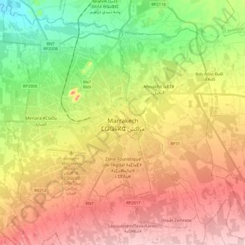
Name: Marrakesh topographic map, elevation, terrain.
Average elevation: 464 m
Minimum elevation: 372 m
Maximum elevation: 555 m